The creek doesn’t look like much from the road — a narrow ribbon of water cutting through steep, tussock-covered hills, the kind of stream you’d cross without a second glance. But drop down to the bank, crouch at the water’s edge, and swirl a pan through the gravel, and the light does something different here. A few dark flecks settle at the bottom, heavier than the sand around them, catching the sun just enough to make a person stop breathing for a second. That flicker of color in the pan is the same one that turned an empty stretch of Otago hillside into the starting point of an entire gold rush, and the same flicker a visitor can still chase today, more than a century and a half later, on a stretch of water that has never really stopped giving up gold.

Gabriel’s Gully: Otago’s Gold Rush Beginning
Gabriel’s Gully sits near the small town of Lawrence, in the Otago region of New Zealand’s South Island, within what is now the Gabriels Gully Historic Reserve. The landscape is classic Otago high country — steep, tussock-covered hillsides folding down into a narrow creek bed, the kind of terrain that channels water, and with it gold, into predictable, workable seams. It was here, in 1861, that a gold strike ignited the Otago gold rush, one of the defining events in New Zealand’s colonial history. Word of payable gold in the gully spread fast, and diggers poured into a part of the South Island that had, until then, seen relatively little European settlement.
The rush that followed reshaped Otago. Lawrence grew up around the gully as a service town for the diggings, and the broader Otago gold rush drew thousands of prospectors from New Zealand, Australia, and further afield, fundamentally shifting the region’s population and economy almost overnight, in a way few single gold strikes anywhere in New Zealand ever matched. Today, the site’s significance is formally recognized: Gabriel’s Gully is preserved as a historic reserve managed by the New Zealand Department of Conservation, which documents the site’s history and maintains public access to it. That official documentation is what makes Gabriel’s Gully more than just a local legend — it’s a verified, government-recorded starting point for a gold rush that helped define an entire region’s identity, not a claim resting on word of mouth alone.
For the modern prospecting and fossicking community, Gabriel’s Gully occupies a rare position: a site with real, documented 1861 gold rush history that remains genuinely accessible today, rather than existing only as a name on a map or a fenced-off historical marker. The creek that gave up the gold in 1861 is the same creek a visitor can pan today, on the same ground, which is part of what keeps the site’s story alive for people who take the hobby seriously — this isn’t a reconstruction or a themed attraction built to evoke the era, it’s the original site itself, still doing what it always did.

The 1861 Rush That Started It All
The 1861 discovery at Gabriel’s Gully didn’t just produce gold — it set off a chain reaction. News of payable gold in the gully spread through Otago and beyond, and prospectors converged on the site in numbers large enough to transform it, almost overnight, from empty hill country into one of the busiest goldfields in New Zealand. That initial rush is what the Otago gold rush is named for, and Gabriel’s Gully is remembered as its ignition point — the place where the broader rush began rather than simply one claim among many scattered across the province, which is why the gully’s name became attached to the entire Otago rush rather than fading alongside dozens of smaller, forgotten diggings.
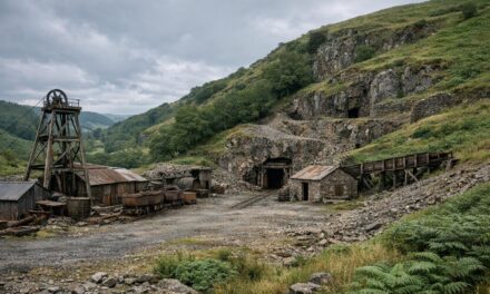
The physical evidence of that intensive, sustained working is still visible on the site today. Historic mine shafts, water races, and hydraulic sluicing faces line the walking track through the reserve — infrastructure built not for a brief, one-season rush, but for organized, larger-scale gold recovery that continued to reshape the landscape well beyond the initial 1861 strike. Water races in particular represent a significant engineering effort: channels built to redirect water for sluicing, evidence of miners investing in permanent infrastructure rather than working the ground for a season and moving on. That layered history — a sudden rush followed by sustained, engineered extraction — is part of what the New Zealand Department of Conservation now documents and preserves at the reserve, and it’s part of what a visitor is actually walking through on the track today.
That preservation effort is also what has shaped the site’s current legal framework. Because Gabriel’s Gully carries this level of documented historical significance, it hasn’t been left to fade into unmarked farmland or been permanently closed off. Instead, under the Crown Minerals Act 1991, the New Zealand government designated the gully as public gold fossicking area GFA 33, formally opening it to recreational panning under permit 42033. That designation is a direct legacy of the 1861 rush: because the gully already carried gold-bearing gravels proven by more than a century of documented mining, it made sense to preserve it not just as a historic site, but as a place where the public could still legally experience the same activity that made it famous in the first place, on the same creek bed that made it famous.
Visiting Gabriel’s Gully Today
Gabriel’s Gully is open to the public for recreational gold panning under New Zealand’s Crown Minerals Act 1991, as designated public gold fossicking area GFA 33 (permit 42033). Visitors don’t need an individual permit to pan here — hand tools only, no motorised equipment or explosives, and panning must stay within the active creek bed rather than disturbing the surrounding reserve. It’s a straightforward, legal way to try the same activity that drew thousands of prospectors to this exact stretch of Otago in 1861, without needing to arrange permission from anyone in advance.
The reserve’s walking track passes historic shafts, water races, and hydraulic sluicing faces, and visitors are advised to stay on the marked path — those old workings represent a real mine shaft and collapse hazard away from the trail. The terrain itself is also worth respecting: the track has a steep start, muddy sections, and stairs, so it’s not a flat, casual stroll, and the remote, hilly setting means it rewards a reasonable level of fitness and sturdy footwear. Flash flooding is another real consideration, since the river can rise suddenly after heavy rain or hydro dam releases; the Department of Conservation specifically advises against the track in wet weather. None of this makes Gabriel’s Gully difficult to visit responsibly — it just rewards a bit of preparation and attention to conditions before heading down to the creek, the same practical caution any prospector would bring to a working creek bed anywhere else.
The Legacy of Gabriel’s Gully
Gabriel’s Gully matters to the prospecting community because it’s a genuine origin point, not a recreation of one. This is the actual ground where the Otago gold rush began in 1861, preserved and documented by New Zealand’s Department of Conservation rather than left to disappear into private farmland or quietly vanish from the map. For anyone serious about the hobby, that combination — verified rush-era history plus real, legal, present-day access — is rare. Few sites let you pan the exact creek bed that started a regional gold rush and legally keep what you find under a clearly defined public fossicking designation. For prospectors traveling through Otago, Gabriel’s Gully is a chance to put a pan in water that has been giving up gold, on and off, since 1861 — and to do it on the same ground, in the same creek bed, where that whole story started.
Story Source: www.doc.govt.nz
Location: Gabriels Gully Historic Reserve, Lawrence, Otago, New Zealand
Site Status: Open to public collecting
Legal Conditions: No New Zealand Tier 1 file exists in this repository yet, so status was researched directly (Verified confidence – NZ Department of Conservation, citing the Crown Minerals Act 1991). Gabriels Gully is NZPAM-designated public gold fossicking area GFA 33 (permit 42033); recreational panning with hand tools only is legal here without an individual permit, provided you stay in the active creek bed and use no motorised equipment or explosives.
Hazards: Mine shaft or collapse hazard (historic shafts, water races and hydraulic sluicing faces along the walking track – stay on marked path); Difficult terrain / altitude / remote access (steep start, muddy sections, stairs); Flash flooding (sudden river rises from heavy rain or hydro dam control; DOC advises against the track in wet weather)
Google Map
Firsthand Accounts
Prospector Gabriel Read described his own May 25, 1861 discovery in his own words: equipped only with “a tin dish, a butcher’s knife and a spade,” he dug through a metre of gravel to reach soft slate, where he “saw the gold shining like the stars in Orion on a dark frosty night.” His account, first made public via a letter reported in the Otago Witness on June 8, 1861, triggered the Otago gold rush within weeks. Source: NZ Department of Conservation, “History of Gabriels Gully” (doc.govt.nz), citing Read’s original 1861 account.
In a September 25, 1862 letter to goldfields commissioner Vincent Pyke, Gabriel Read gave his own narrative of how he came to prospect the Tuapeka country, crediting an earlier prospector named Peters and writing: “I lay no claim to the original discovery of gold in New Zealand but this I insist upon, that I, unaided, was the first to prove that we had goldfields which were capable of producing profitable results.” Source: Gabriel Read, letter to Vincent Pyke, Sept. 25, 1862, held by Archives New Zealand, Dunedin, as reported in “Rare 1862 letter by Gabriel Read on display,” Otago Daily Times, March 22, 2011.