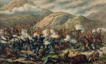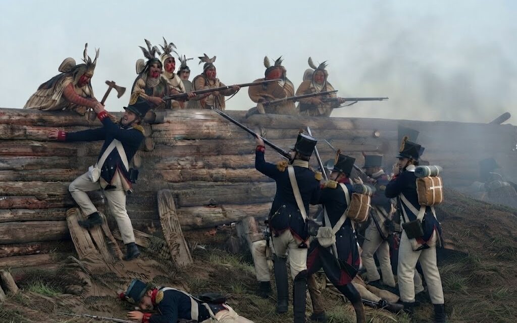
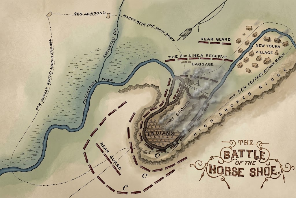
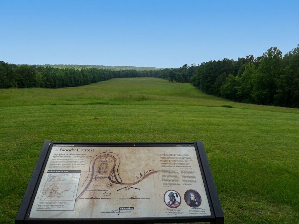
The Tallapoosa River bends here into an almost complete loop, curling back on itself until only a narrow neck of land, less than a hundred yards wide, connects the peninsula it encloses to the outside world. In the spring of 1814, several hundred Red Stick Creek warriors and their families built their strongest defensive works across that narrow neck, certain the natural moat curling around the rest of the position made the site nearly impregnable. They were right about the neck. They had not counted on several hundred allied warriors quietly swimming the river at their backs, stealing the canoes drawn up along the bank, and closing off the one escape route the water itself was supposed to guarantee.
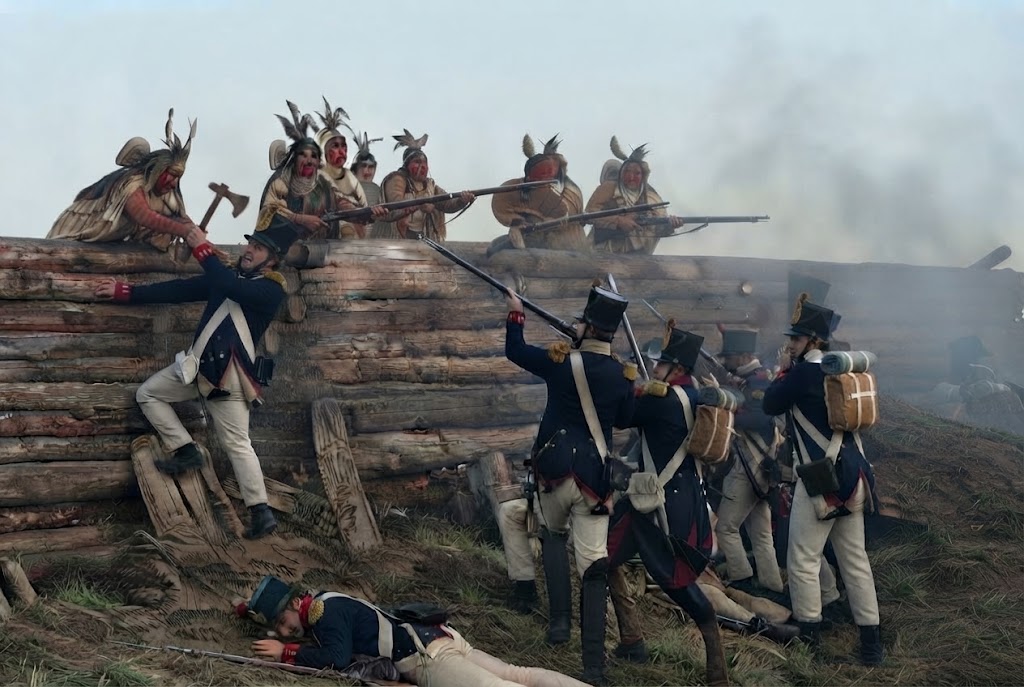
Battle of Horseshoe Bend: The Road to Battle
The battle grew out of a civil war within the Creek Nation itself, between traditionalist Red Stick Creeks, who drew inspiration from the pan-Indian resistance movement led by the Shawnee leader Tecumseh, and Creek factions willing to accommodate continued American expansion into their territory. Tecumseh had traveled south to visit the Creek in 1811, urging resistance to American expansion as part of a broader pan-Indian confederacy he was attempting to build across the frontier, and his message found its strongest following among the Red Sticks, who took their name from the red war clubs that symbolized their commitment to armed resistance. That internal conflict widened into a broader war in August 1813, when Red Stick forces attacked Fort Mims in the Mississippi Territory, killing several hundred people and prompting the United States to intervene militarily on a large scale. Major General Andrew Jackson, commanding Tennessee militia, spent the following winter campaigning against Red Stick strongholds, fighting engagements at Tallushatchee and Talladega before turning toward the Red Sticks’ fortified position on the Tallapoosa River, known to its defenders as Tohopeka.
By late March 1814, Jackson had assembled a force of roughly 3,300 men, combining U.S. Army regulars, Tennessee militia, and allied Cherokee and Creek warriors who had chosen to fight alongside the Americans rather than join the Red Stick cause. Jackson’s march to Horseshoe Bend followed months of difficult campaigning through Creek territory, with supply shortages and expiring militia enlistments repeatedly threatening to end the effort before it reached its objective, and only reinforcements arriving in early March allowed him to press forward against Tohopeka rather than withdraw. The Red Sticks gathered at Horseshoe Bend numbered closer to a thousand warriors, along with women and children sheltering behind the peninsula’s natural river barrier, and had spent weeks building a substantial log breastwork across the narrow neck of land that offered the only approach from open ground.
The Battle of Horseshoe Bend
On the morning of March 27, 1814, Jackson opened the engagement with roughly two hours of artillery bombardment against the log breastwork, but the defensive works proved sturdy enough to absorb the cannon fire without collapsing. Jackson’s artillery amounted to only two small cannon, insufficient to breach log walls that in places stood several feet thick, and after two hours of bombardment the breastwork remained essentially intact despite the barrage. Major General Andrew Jackson’s own official report afterward called the position one of the most defensible he had ever encountered, describing the two-hour bombardment, the frontal assault that followed, and the near-total destruction of the Red Stick force in detail that later became the single most-cited primary account of the battle. While the bombardment continued, a separate force under General John Coffee moved to surround the bend from across the river, and roughly 500 allied Cherokee warriors swam the Tallapoosa at the Red Sticks’ rear, seized the canoes drawn up along the bank, and used them to cross and attack Tohopeka from behind — a maneuver most historians credit as the tactical key to the battle’s outcome, since it cut off the one route by which the defenders might otherwise have escaped or been resupplied. Coffee’s mounted force had circled the bend overnight to seal off the peninsula’s river side before the main assault began, ensuring that once the Cherokee swimmers cut off the canoes, no Red Stick fighter could easily escape by water in either direction.
With the rear attack underway, Jackson ordered a frontal assault directly over the log breastwork. Third Lieutenant Sam Houston, then twenty-one years old and serving under Colonel John Williams’s 39th Infantry, was among the first men over the barricade, where a Red Stick arrow struck him in the thigh; he continued fighting, later volunteering to help clear the last defenders from the position and taking two additional gunshot wounds before the day was over, injuries that troubled him for the rest of his life. His commanding officers later cited his conduct that day, despite his wounds, as an early example of the battlefield courage that would define his reputation in the years that followed, long before his name became associated with Texas. Chief Menawa of Okfuskee, commanding the Red Stick defenders, was wounded seven times in the fighting but survived, eventually escaping by canoe under cover of darkness and leading roughly 200 survivors toward Spanish Florida as the position collapsed entirely around them.
By the time the fighting ended, the Red Stick force at Horseshoe Bend had been almost completely destroyed, with historians generally estimating somewhere between 800 and 900 killed, among the highest single-day death tolls of any battle fought on North American soil during the era. Some later analyses have suggested the true death toll may have been even higher, since accounts describe extensive destruction of the village in the battle’s aftermath rather than a complete count, and several hundred women and children were taken captive during and after the fighting. Jackson’s combined force lost a comparatively small number killed, with a larger number wounded among both the American troops and their Cherokee and Creek allies, a lopsided outcome that reflected both the effectiveness of the encirclement and the defenders’ decision to make a final stand rather than abandon the position.
The Legacy of Horseshoe Bend
The battle effectively ended organized Red Stick resistance and, with it, the broader Creek War. Five months later, the Treaty of Fort Jackson forced the Creek Nation, including the very Creek allies who had fought alongside Jackson, to cede more than twenty million acres of land, encompassing roughly half of present-day Alabama along with a portion of Georgia. The victory made Andrew Jackson a national figure, propelling him toward his later command at the Battle of New Orleans and eventually the presidency, while Sam Houston went on to a prominent career of his own, culminating decades later in the leadership of Texas. The scale of the land cession at Fort Jackson made it one of the largest single land transfers ever extracted from a Native American nation in U.S. history, reshaping the demographic map of the Deep South as settlers moved onto the newly ceded territory.
Visiting Horseshoe Bend Today
The battlefield is preserved today as Horseshoe Bend National Military Park, administered by the National Park Service near the town of Daviston, Alabama, within reach of Alexander City and Dadeville. Admission is free, and a visit typically takes one to two hours, taking in the visitor center’s film and museum exhibits along with a three-mile auto tour road and a nature trail that follows the battlefield and the riverbank where the decisive crossing took place.
Spring and fall are generally the most comfortable seasons to visit, since Alabama summers bring heat and insects that can make walking the nature trail less pleasant. The park holds a living-history commemoration each March around the anniversary of the battle, along with a historians’ symposium each August, giving visitors two distinct windows for a more immersive visit built around scheduled programming rather than a standard self-guided stop. The museum exhibits trace the battle from both the American and Creek perspectives, drawing on archaeological work done on the site alongside the primary accounts left by participants such as Jackson, Houston, and Menawa, and the auto tour road includes interpretive stops at several of the battle’s key locations, from the breastwork site to the point along the riverbank where the Cherokee crossing took place. Because the park sits in a fairly rural part of east-central Alabama, visitors typically combine a stop here with other stops in the region rather than treating it as a standalone destination, and the modest scale of the site means most people can see everything it offers without needing to rush, making it a comfortable half-day addition to a broader trip through east-central Alabama.
Remembrance at Horseshoe Bend
Horseshoe Bend’s annual commemorations, timed to the battle’s late-March anniversary, keep the site’s memory active well beyond the pages of the history books that first recorded it, bringing together interpreters, historians, and visitors for a more immersive engagement with the battle than a typical self-guided park visit allows. The August historians’ symposium serves a different purpose, drawing scholars to reexamine the battle and the broader Creek War from an academic angle rather than a commemorative one, a combination that gives the park two distinct annual touchpoints for engaging with the site’s history. The auto tour road and nature trail, tracing the ground from the breastwork site down to the riverbank the Cherokee warriors crossed, let visitors walk the same narrow neck of land that made the position both a fortress and, in the end, a trap. The March commemoration and August symposium together give the park a rhythm most single-day battlefields lack, spreading engagement with the site’s history across the calendar rather than concentrating it into one annual event, and both draw participants well beyond the immediate region given the battle’s significance to the broader history of the War of 1812 era and the Creek War that unfolded alongside it.
Visitor Info: Book titled “Tohopeka: Rethinking the Creek War and the War of 1812” (ed. Kathryn E. Holland Braund, 2012)
Location: Horseshoe Bend National Military Park, 11288 Horseshoe Bend Road, Daviston, AL 36256
Site Status: National Park / Managed Historic Site
Visitation Notes: The nearest town is Daviston, Alabama, within reach of Alexander City and Dadeville. Spring and fall are the best seasons to visit, since summers are hot and buggy; a living-history commemoration is held each March around the battle’s anniversary, with a historians’ symposium each August. Admission is free, with a visitor center film, museum, a 3-mile auto tour road, and a nature trail along the battlefield and riverbank — allow 1-2 hours.
Google Map
Visitor Comments
esprouls47 called the park off the beaten path but well worth the visit, praising the friendly, knowledgeable staff and the 24-minute film covering the battle’s five documented stops.
— from TripAdvisor
valliam13 spent about two hours touring the museum and driving tour, praising a friendly park ranger who made the visit worthwhile.
— from TripAdvisor
Charlestonvisitor454 praised a staff member by name for exceptional knowledge and highlighted the live military equipment display as a highlight of the visit.
— from TripAdvisor
A national-parks travel blogger, Park Ranger John, called the 3-mile auto tour road their favorite part of the park, noted the minimal crowds, and advised bringing water and snacks since there’s no food on site, avoiding poison ivy on the nature trail, and visiting in spring or fall to skip the summer heat and bugs.
— from parkrangerjohn.com